


2017年4月26日発売!
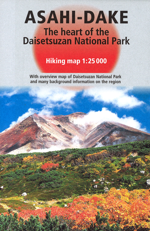


大雪山 旭岳登山英語地図
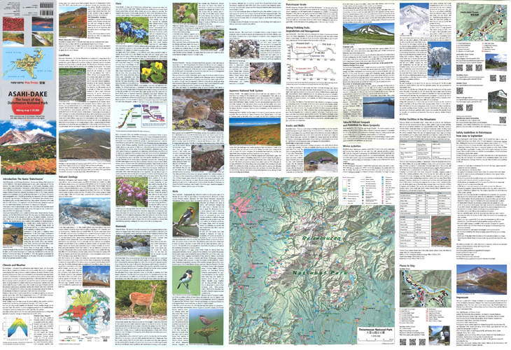
ASAHI-DAKE The heart of the Daisetsuzan National Park
Hiking map 1:25000 ★English version★
渡邉悌二、マルクスハウザーほか/著
Teiji Watanabe(Author),Markus Hauser(Author)
本体1,800円+税
両面オールカラー
660×960mm(1枚もの、折り畳んだサイズ:165×107mm)
ISBN 978-4-906740-27-7 C0426
山岳大国スイスの地図製作会社と北大教授のコラボで制作された、
外国人登山者待望の英語登山地図が誕生!
- 山岳事故の危険性が懸念される、外国人登山者の増加が著しい大雪山国立公園。この英語地図は外国人登山者の事故を防ぐことを目的に、北海道大学・渡邉悌二教授とスイスの地図製作会社Orell Fussli Kartographie AG・マルクス ハウザーが共同制作したものです。
- 表面の2万5千分1地形図には、環境省作成の登山道難易度区分を、市販地図で初掲載。日本語を併記して日本人の使用にも対応しました。山岳大国スイスで制作したものだけに、地図自体の美しさも魅力です。さらに裏面には、20名以上の専門家らが執筆した大雪山国立公園の自然や環境についての英語情報を掲載。北海道観光の国際化に対応した、待望の英語登山地図です。
Production Description
A new English hiking map long awaited by international visitors
Produced in collaboration with Japanese and Swiss
Alice Inc., Sapporo, Japan released a new English hiking map for international visitors to Daisetsuzan National Park, central Hokkaido, which was made in collaboration with Japanese researchers including professors of Hokkaido University and the Swiss map production company, Orell Fussli Kartographie AG.
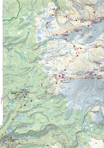
In addition to a beautiful 1:25,000 topographic map, created with the state-of-the-art technique of Switzerland, a leading map production country, this map carries the `Daisetsuzan Grade', a new trail-classification system developed by the Ministry of the Environment. The grade, together with suggested walking time and the place names both in English and Japanese, will give all international users suitable route plans.
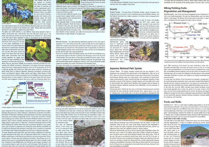
Its backside carries brief descriptions on necessary information such as nature, environment, and facilities, which are written by experts of the disciplines.
Editorial Reviews
This English map, developed by Markus Hauser of Orell Fussli Kartographie AG and Teiji Watanabe of Hokkaido University, is a long-awaited map by international hikers visiting Daisetsezan National Park, a still unknown mountain area with untouched nature located in northern Japan.
誌面
地図の表面では、1:25,000地形図で旭岳周辺の登山ルートを紹介。市販地図初掲載となる環境省作成「登山道難易度区分」と所要時間を収載したほか、地名はすべて英語と日本語を併記しました。さらに、国土地理院作成の地形図をもとに、山岳大国スイスならではの技術で彩色された地図の美しさも特筆すべき点です。
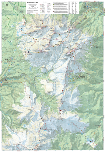
↓一部拡大
地図の裏面では、20人余りの各分野の専門家が執筆した大雪山国立公園の自然や環境などの英語情報も掲載。写真をふんだんに使い、充実した読み物となっています。さらに、大雪山国立公園の全体地図、旭岳温泉・層雲峡温泉の各温泉街地図なども収録し、実用性にも配慮しました。
↓一部拡大
著者プロフィール
渡邉悌二(わたなべ・ていじ)
北海道大学大学院(地球環境科学研究院・統合環境科学部門環境地理学分)教授。
地理学の視点から、山岳国立公園を主とする山岳保護地域の自然環境の保全と公園管理、ジオ多様性(ジオダイバーシティ)の保全とジオ・エコツーリズムなどを研究分野とする。日本地理学会、東京地学会、Arctic Institute of North America International Mountain Society、国際環境研究協会、日本エコツーリズム協会、大雪山研究者ネットワーク、北海道山岳連盟所属。著書に『登山道の保全と管理』(編著、2008・古今書院)、工藤岳編『高山植物の自然史―お花畑の 生態学』(執筆、2000・北海道大学図書刊行会)など。
About the author
Teiji Watanabe is a professor of the Faculty of Environmental Earth Science and the Graduate School of Environmental Science, Hokkaido University.
Having a background in alpine geomorphology, he is interested in mountain geoecology, with interests in interactions of human geo-ecosystems in high mountain areas and natural resource management in protected areas.